
- Details
- More images
Products description
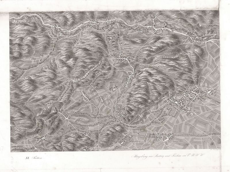
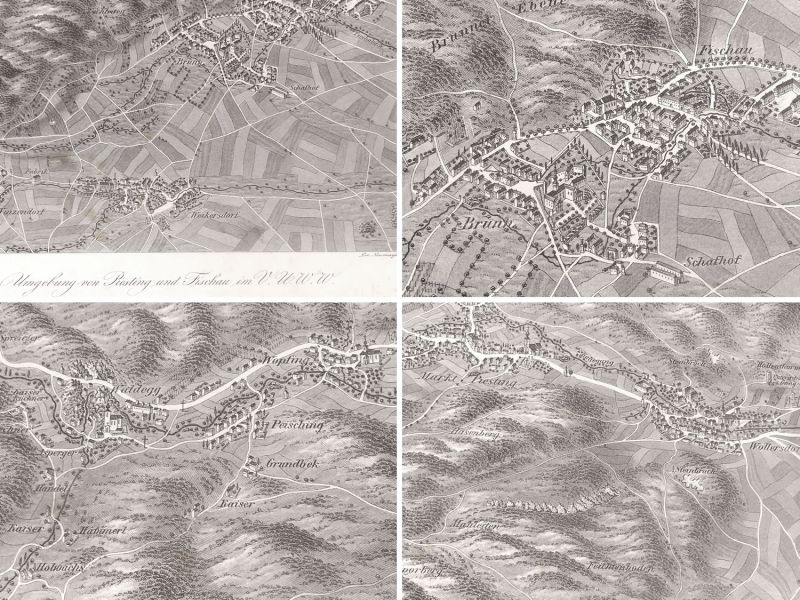
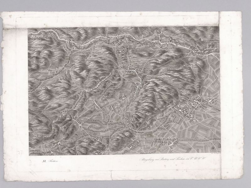
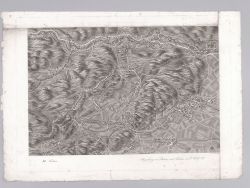
Historical map of Piesting, Fischau & surroundings, ca. 1835.
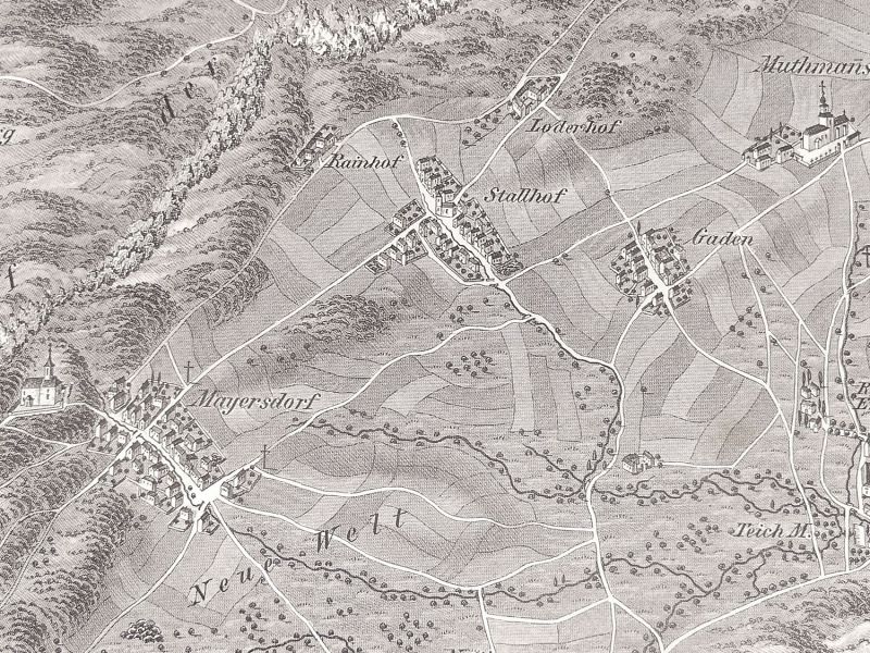
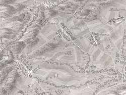
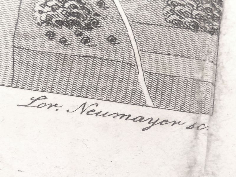
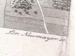
Are you looking for an original historical map from your hometown, your birthplace, or would you like to discover historical evidence? This rare map is a true treasure for historians, local researchers, and collectors: it dates back to the 19th century and shows the area around Markt Piesting and Bad Fischau circa 1835. On this detailed map you can find numerous places and historical sites, for example: Oed, Wopfing, Markt Piesting, Wöllersdorf, Muthmannsdorf, Bad Fischau, Weikersdorf, Winzendorf, Maiersdorf, Hohe Wand, and many more. The map is a copper engraving by L. Neumayer from Schweickhardt von Sickingens work Perspectiv-Karte des Erzherzogtums Österreich unter der Enns. It offers a historic birds-eye view with many fine details: roads, houses, churches, old paths, vanished villages (deserted settlements), castles and ruins, gallows trees, mills, settlements, individual buildings, groups of trees, rivers, and streams are all finely depicted on these maps. Such maps are a fascinating representation of the cultural landscape of the Biedermeier era and are of great historical significance. Dimensions: approx. 38.5 × 54.5 cm framed / approx. 29 × 43.5 cm unframed; condition: the map itself is well preserved; foxing on the front and back; the edges show age-related tears and stains. The map was partly folded at the edges. Age-appropriate signs of wear (see photos)! With a suitable passe-partout, this map becomes a real eye-catcher for your home, office, or collection.
Are you looking for an original historical map from your hometown, your birthplace, or would you like to discover historical evidence? This rare map is a true treasure for historians, local researchers, and collectors: it dates back to the 19th century and shows the area around Markt Piesting and Bad Fischau circa 1835. On this detailed map you can find numerous places and historical sites, for example: Oed, Wopfing, Markt Piesting, Wöllersdorf, Muthmannsdorf, Bad Fischau, Weikersdorf, Winzendorf, Maiersdorf, Hohe Wand, and many more. The map is a copper engraving by L. Neumayer from Schweickhardt von Sickingens work Perspectiv-Karte des Erzherzogtums Österreich unter der Enns. It offers a historic birds-eye view with many fine details: roads, houses, churches, old paths, vanished villages (deserted settlements), castles and ruins, gallows trees, mills, settlements, individual buildings, groups of trees, rivers, and streams are all finely depicted on these maps. Such maps are a fascinating representation of the cultural landscape of the Biedermeier era and are of great historical significance. Dimensions: approx. 38.5 × 54.5 cm framed / approx. 29 × 43.5 cm unframed; condition: the map itself is well preserved; foxing on the front and back; the edges show age-related tears and stains. The map was partly folded at the edges. Age-appropriate signs of wear (see photos)! With a suitable passe-partout, this map becomes a real eye-catcher for your home, office, or collection.
Quick purchase
Welcome back!
Newsletter subscription
E-mail address:
The newsletter can be canceled here or in your Account at any time.
Social Media
Payment methods
Raritaeten-Shop © 2026 | Template © 2009-2026 by modified eCommerce Shopsoftware
modified eCommerce Shopsoftware © 2009-2026