
- Details
- More images
Products description
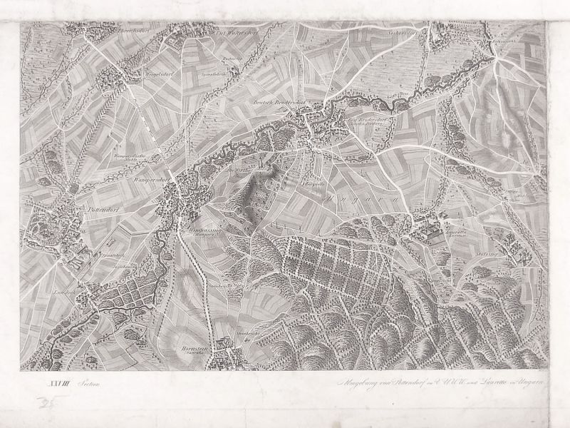
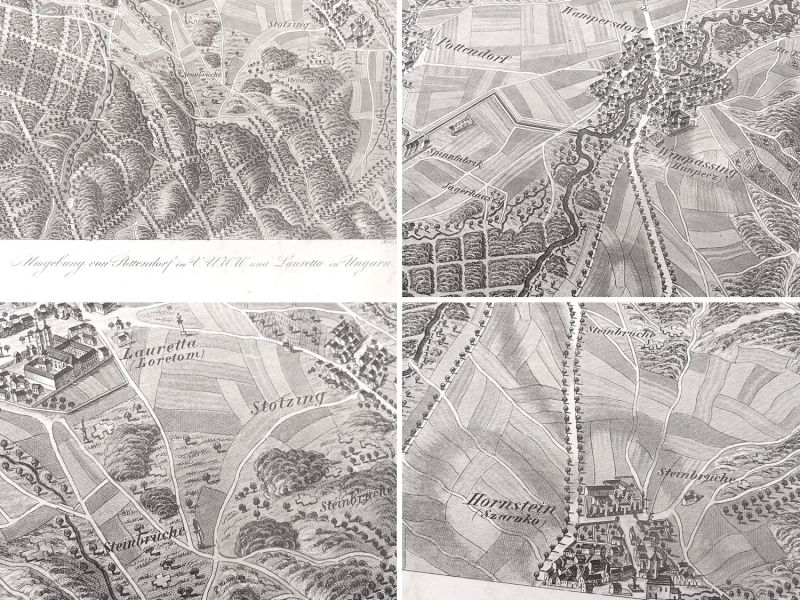
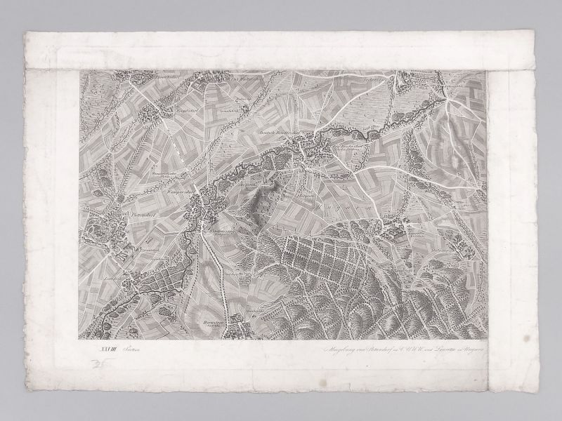
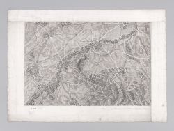
Historical map of Pottendorf, Loretto & surroundings, approx. 1835
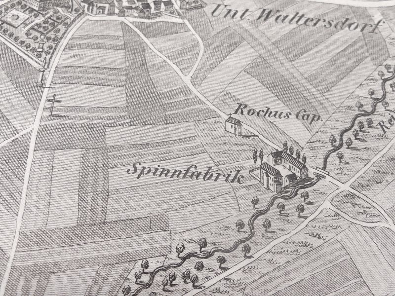
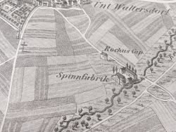
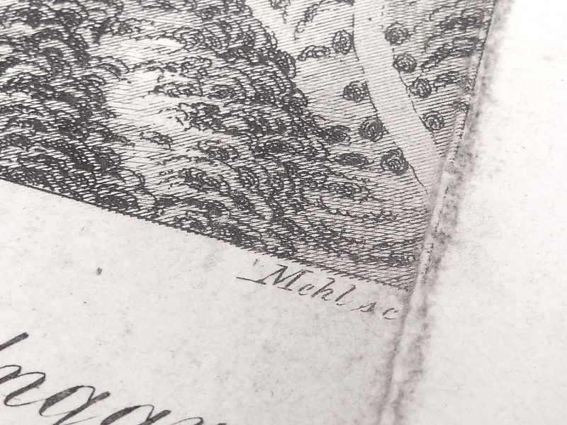
Are you looking for an original historical map of your home region or birthplace, or would you like to discover historical documents? This rare map is a treasure trove for historians, local historians and collectors: it dates from the 19th century and shows the area around Pottendorf and Lauretta (Loretto) in Hungary around 1835. Numerous towns and historical sites can be found on this detailed map, for example: Pottendorf, Wampersdorf, Deutsch Brodersdorf, Seibersdorf, Wimpassing, Hornstein, Loretto, Stotzing, Weigelsdorf, Ebreichsdorf and many more. The map is a copperplate engraving by Mehl sc., from Schweickhardt von Sickingens work Perspective Map of the Archduchy of Austria below the Enns. It offers a historical bird's-eye view with many details: roads, houses, churches, old paths, vanished villages (deserted settlements), castles and ruins, gallows trees, mills, settlements, individual buildings, groups of trees, rivers and streams are finely reproduced on these maps. Such maps are a fascinating reflection of the cultural landscape of the Biedermeier period and are of great historical significance. Dimensions: approx. 38.5 × 54.5 cm with frame / approx. 28.5 × 43.5 cm without frame; Condition: The map itself is in good condition; foxing on the front and back; the edges show age-related tears and stains. The map was partially folded at the edges. Signs of wear consistent with its age (see photos)! With a matching passe-partout, this map will be a real eye-catcher for your home, office or collection.
Are you looking for an original historical map of your home region or birthplace, or would you like to discover historical documents? This rare map is a treasure trove for historians, local historians and collectors: it dates from the 19th century and shows the area around Pottendorf and Lauretta (Loretto) in Hungary around 1835. Numerous towns and historical sites can be found on this detailed map, for example: Pottendorf, Wampersdorf, Deutsch Brodersdorf, Seibersdorf, Wimpassing, Hornstein, Loretto, Stotzing, Weigelsdorf, Ebreichsdorf and many more. The map is a copperplate engraving by Mehl sc., from Schweickhardt von Sickingens work Perspective Map of the Archduchy of Austria below the Enns. It offers a historical bird's-eye view with many details: roads, houses, churches, old paths, vanished villages (deserted settlements), castles and ruins, gallows trees, mills, settlements, individual buildings, groups of trees, rivers and streams are finely reproduced on these maps. Such maps are a fascinating reflection of the cultural landscape of the Biedermeier period and are of great historical significance. Dimensions: approx. 38.5 × 54.5 cm with frame / approx. 28.5 × 43.5 cm without frame; Condition: The map itself is in good condition; foxing on the front and back; the edges show age-related tears and stains. The map was partially folded at the edges. Signs of wear consistent with its age (see photos)! With a matching passe-partout, this map will be a real eye-catcher for your home, office or collection.

Quick purchase
Welcome back!
Newsletter subscription
E-mail address:
The newsletter can be canceled here or in your Account at any time.
Social Media
Payment methods
Raritaeten-Shop © 2026 | Template © 2009-2026 by modified eCommerce Shopsoftware
modified eCommerce Shopsoftware © 2009-2026